Chiricahua Becomes a National Park, Without Dedicated New Funding
Chiricahua in southeastern Arizona became a national park, raising its profile without new funding or expanded visitor services. The park’s boundaries and budget remain the same, preserving its natural and cultural features.
Get the week’s jobs, development, housing and growth stories from across the Sun Belt in one email.
Chiricahua has a new national-park name, but not a new pot of money to go with it.
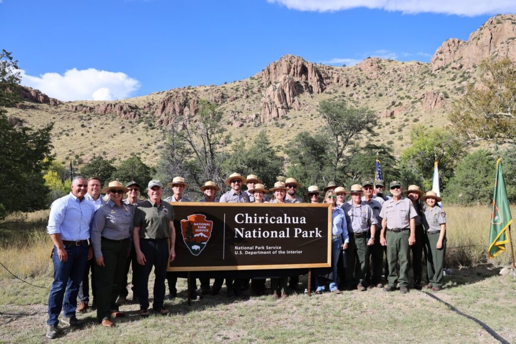
The southeastern Arizona landscape of rock spires and balanced boulders became Chiricahua National Park on Oct. 20, when President Donald Trump signed its redesignation into law. For travelers, the change brings a more familiar label to a place protected as a national monument since 1924. For park employees, the work continues within the existing budget.
The National Park Service announced the designation near Willcox, where roughly 12,000 acres preserve volcanic formations, wildlife habitat and the homeland of the Chiricahua Apache.
A new name, the same boundaries
The Chiricahua National Park Act keeps the former monument’s boundaries and makes its existing funds available to the national park. It does not provide a dedicated new appropriation.
That distinction matters as the new name raises the park’s profile. The Park Service expects greater public awareness but has not offered a specific forecast for additional visitors or local spending. Chiricahua received 70,406 recreational visits in 2025.
No new construction is planned because of the redesignation. Signs and printed materials will change gradually as funding permits, so visitors may continue to encounter the old national-monument name. Staffing and future budgets remain subject to the regular appropriations process, the agency says.
Existing protections, fees and permit rules continue. Hiking, camping and scenic drives remain part of a visit; the title does not itself create a larger campground or more parking.
Rock formations and a living cultural landscape
Chiricahua’s rhyolite spires formed from volcanic material deposited about 27 million years ago. Desert, grassland and forest meet in the surrounding mountains, creating the varied habitats associated with the region’s “sky islands.”
The park also preserves Faraway Ranch and other historic places. Its cultural significance extends well beyond the buildings: this is Chiricahua Apache homeland, with continuing connections to tribal communities.
The law requires protection of traditional cultural and religious sites and consultation with tribes. It also provides tribal members access for traditional uses and allows temporary public closures of specific areas, when requested by a tribe, to protect those activities. Such closures must cover the smallest practical area for the shortest necessary period.
What visitors should know
Parking can already be difficult on weekends and holidays from October through April. March is particularly busy, as is the week between Christmas and New Year’s, according to the Park Service’s visitor guidance. The agency plans to monitor activity at places including Massai Point, Echo Canyon and Bonita Canyon Campground.
Travelers should not count on a hiker shuttle: hiker transport is not currently running. For navigation to the visitor center, use 13063 E. Bonita Canyon Road. From Willcox, Highway 186 provides a paved approach.
Check current park conditions before leaving, especially as winter approaches. Snow is possible from November through April, and dogs are prohibited on many trails. A new name makes Chiricahua easier to recognize on a travel itinerary; planning for its existing roads, parking and services is still essential.
Photograph: National Park Service. No claim to original U.S. Government works.
Community Voice
A snapshot of reader views, not a scientific survey.
Explore Community Voice →About the Desk

Across the Sun Belt
Florida Faces Long Recovery After Hurricane Isaias as Thousands Remain Without Power and Emergency Aid Opens
Isaias Leaves More Than 750,000 Without Power After Striking Florida

Arizona Opens Aerospace Training Center Built to Serve 1,000 Students a Year
Tropical Storm Isaias Could Become First Hurricane of 2026 Before Gulf Coast Landfall

10 of 11 States Above the National Poverty Rate Are in the South