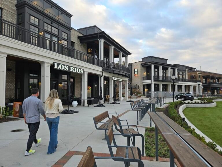
Milton Development Update 2026: Roads, Downtown, and What’s Next
Get major local stories and development updates.
This article is part of our ongoing 2026 Development Update series examining how public projects and private investment are reshaping North Atlanta.
Milton’s development story in 2026 is not about dramatic skyline changes or large waves of new density. Instead, it’s about something quieter and more deliberate: how the city continues to evolve while protecting its rural-residential character.
In its own financial reporting, Milton describes itself as both rural and suburban. Most of its land remains oriented toward residential, agricultural, and equestrian uses. Only a small share is planned for commercial development. That framework explains a lot about what “development” means here.
In Milton, the most consequential decisions are rarely new subdivisions. They are investments in roads, stormwater systems, trails, school-area safety, park upgrades, and small, targeted commercial areas like Downtown Crabapple and Deerfield.
The 2026 outlook is shaped by three main forces:
- Transportation projects funded through TSPLOST and state or federal grants
- Zoning amendments that fine-tune how development looks and feels rather than dramatically redrawing the map
- Continued emphasis on greenspace, trails, and park infrastructure
All of this happens while nearby job centers and retail hubs in Alpharetta and Roswell continue to grow — pulling traffic through Milton’s corridors and increasing pressure on key roads.
Major Infrastructure Projects Residents Will Notice
The biggest near-term impacts are concentrated along a few corridors:
- Crabapple Road / Birmingham Highway (SR 372)
- The Deerfield area (especially Morris Road and pedestrian connections)
- Cox Road
- The Highway 9 spine
To fund these projects, Milton relies heavily on TSPLOST — a 0.75% transportation sales tax in Fulton County dedicated to road improvements, sidewalks, intersections, and trail planning.
In parallel, the city is leveraging federal grants. The “Safety in Action” initiative is tied to $1 million in federal Safe Streets for All funding and runs through 2026. It focuses on roundabout safety, corridor audits, and accessibility improvements tied to city facilities and public right-of-way.
Timeline of Key Projects Residents Will Feel
| Project / Corridor | What’s Happening | Funding / Lead | Status (Early 2026) | What Residents May Notice |
|---|---|---|---|---|
| Crabapple Rd at Green Rd | Temporary traffic signal; longer-term roundabout planning | GDOT + federal prelim engineering request (20% TSPLOST match) | Council authorized $1M federal request; GDOT installing temporary signal | Short-term signal changes; future roundabout design discussions |
| Crabapple Road streetscape | Median, crosswalk, pedestrian beacon in Downtown Crabapple | City-led (SR 372 approvals required) | Median completed 2024; beacon work scheduled through 2025 | More defined crossings and calmer streetscape feel |
| Birmingham Highway school-area focus | Congestion and safety improvements near schools | Expected TSPLOST + GDOT; coordination with Fulton County Schools | Public open house held Sept. 2025; options under review | Possible turn lanes, sidewalks, school-time traffic adjustments |
| Morris Road (Deerfield) | Widening + multi-use path + stormwater + utility relocation | TSPLOST; coordinated with GDOT interchange work | Completion targeted by end of 2026 | Extended construction; eventual four-lane corridor |
| Big Creek Greenway connection | 10-foot multi-use path + stormwater + landscaping | 80% federal; remainder TSPLOST/Fulton County | Construction agreement approved early 2026 | Improved trail connectivity; temporary routing impacts |
| Cox Road intersections | Intersection upgrades and roundabouts | TSPLOST II; shared with Roswell in parts | Right-of-way steps active in 2025–2026 | Localized detours near Legacy Park and commute routes |
| Highway 9 concept work | Engineering + land acquisition services | GDOT-funded engineering; City leads delivery | Concept analysis and outreach phase | Long-term reshaping of access and turning movements |
| GDOT bridge replacements | Multiple bridge replacements across Milton | Fully GDOT funded (baseline) | Five bridges identified; optional City design enhancements | Detours and localized traffic shifts |
Project summaries above are drawn from Milton’s published project pages and Council agenda recaps — the most reliable indicators of timing, funding, and delivery phases.
Stormwater and Drainage: The Less Visible Story
Stormwater infrastructure is becoming a more visible part of Milton’s development conversation.
Recent Council discussions show that drainage and erosion are not secondary issues — especially where gravel roads, aging infrastructure, and increased traffic intersect.
On Morris Road, for example, the widening requires a 70-foot culvert extension, new headwalls, water main relocations, and power pole adjustments. On Sweetapple Road, the City launched engineered drainage design work to address erosion concerns on a gravel corridor with limited stormwater facilities.
At a regulatory level, Milton continues to manage its MS4 stormwater permit requirements, which involve multiple “minimum control measures” and best management practices. These efforts rarely make headlines, but they shape how growth interacts with creeks, slopes, and long-standing rural roads.
What’s Changing in Downtown
Downtown Crabapple continues to change in “small but cumulative” ways: pedestrian safety investments, streetscape work, and incremental commercial infill that sits under closer design review than typical suburban retail.

Streetscape and safety: medians, crossings, and the next intersection decision
In late summer 2024, the City installed a new median along Crabapple Road roughly between Olde Blind Dog and Knuckies, describing it as part of a City-run streetscape project (with GDOT approval required because Crabapple Road is SR 372 in that segment). The City also tied the project to a mid-block crosswalk and later installation of a pedestrian hybrid beacon and mast arm.
By March 2025, the City was installing that pedestrian hybrid beacon and mast arm and described an expected completion by the end of March, after earlier crosswalk work had already improved the connection between businesses on both sides of Crabapple Road.
Looking forward from early 2026, the biggest “next step” downtown is not mid-block—it’s the Crabapple/Green intersection. The City described a temporary traffic signal (paid for by GDOT) to be installed in early 2026, while also advancing an application for federal funds to cover preliminary engineering for a roundabout with a required local match from TSPLOST.
Market District Crabapple: a notable absorption milestone
One of the clearest, confirmed commercial indicators in Crabapple has been absorption at Market District Crabapple. In April 2024, the City described the development as “100% leased” or having active lease agreements in place, and listed a mix of office, service, and restaurant tenants. The City also hosted ribbon cuttings for specific businesses on site (including a photography studio, a dental office, Suite 200, and a restaurant).
For residents, that matters less as a marketing claim and more as a practical downtown signal: when second-floor offices and service providers fill in, weekday traffic patterns, parking demand, and “daytime downtown” activity tend to rise even without major new buildings.
Code and design oversight: District at Mayfield and active Design Review Board cases
Milton’s “District at Mayfield” framework is important to Crabapple because it reflects how the City is trying to manage change: through concept plans and text amendments rather than blanket rezoning. The City describes this district as a nearly 19-acre area encompassing 23 parcels in Crabapple, built around a citizen-informed concept plan and corresponding code text amendments intended to drive consistency and cohesiveness, explicitly noting that the effort involved “no rezoning.”
In 2025, Crabapple-related items continued to come through the Design Review Board process. A City agenda preview described DRB consideration of demolitions in the District at Mayfield and review activity for a proposed Seven Brew drive-thru coffee shop near a Walmart entrance on Highway 9, alongside exterior changes for downtown buildings.
Taken together, the Crabapple pattern is consistent: modest new construction potential, but active oversight of demolition, appearance, and public-facing site changes—an approach that tends to generate fewer “surprise” impacts but more frequent small public hearings.
Residential Development: Estate Lots and New Subdivisions
Milton’s residential development baseline—large lots, conservation-minded expectations, and rural viewshed concerns—shows up repeatedly in official documents and zoning changes.
In the City’s FY2024 financial reporting, Milton states that approximately 84.4% of the city’s land area “can be developed only for residential or agricultural/equestrian purposes,” while only 2.6% is planned for commercial development (with the remainder described as right-of-way, wetlands, schools, cemeteries, and parkland).
New plats and the “where” of subdivision pressure
Recent public records show a mix of small-lot proposals near activity centers and continued large-lot subdivision activity elsewhere.
A notable infill-adjacent example is the “Echo” neighborhood. In March 2025, the City approved a final plat for 23 single-family lots on less than five acres off Crabapple Road, describing it as the final step allowing the developer to begin selling lots and “go vertical,” and noting the use of underground water detention rather than a stormwater pond.
On the large-lot side, the Planning Commission’s October 2025 agenda included “Little River Farms, Phase 2,” described as 10 lots on 16.6 acres at a density of 0.60 units per acre. This type of math—low units per acre—aligns more closely with Milton’s estate-lot expectations than with typical suburban subdivision patterns.
Where community pushback shows up
Milton’s most visible residential-development conflict tends to surface when attached housing or higher-density formats appear near established neighborhoods.
Planning Commission minutes from April 2025 (covering a townhome preliminary plat request to subdivide 3.87 acres into 20 units) show a formal public process with significant opposition: 13 speakers opposed, plus additional written opposition, after which the Commission postponed further discussion and scheduled another public hearing.
That record is useful because it highlights how “density debates” in Milton often play out: not as abstract arguments, but as specific site plans navigating traffic, buffering, stormwater, and neighborhood compatibility in highly attended hearings.
Zoning and code updates affecting lots, trees, and rural character
A key theme in Milton’s recent zoning activity is targeted text amendments that adjust development rules without rewriting the entire zoning map.
In late 2025, the City described a proposed amendment (RZ25-08) that would change how front/rear setbacks are allocated for qualified limited-access subdivisions—keeping the overall setback area the same, but shifting configuration to emphasize tree canopy preservation and reduce impacts to neighboring properties. The same amendment would increase minimum setbacks for pools, pool decks, and equipment.
Along the Arnold Mill corridor, Milton’s Small Area Plan documentation shows the City Council adopted an overlay and adopted the plan in May 2025, with the City emphasizing that the planning effort did not begin as a rezoning initiative and that it did not intend to extend sewer in that area.
Later, a related text amendment discussion (RZ25-10) was described as allowing narrower “hamlet-style” lots along parcels abutting Arnold Mill Road while keeping the existing 100-foot rural viewshed requirement along the road.
On the drainage and infrastructure side of the code, the Planning Commission’s April 2025 agenda also included a text amendment (RZ25-06) related to stormwater facility references across multiple parts of the Unified Development Code, signaling that even “behind the scenes” engineering standards continue to be updated through public process.
New Business Openings in Milton
Milton’s commercial growth in 2026 is best understood in two layers: confirmed incremental openings (especially in Crabapple), and larger “planning-stage” moves in corridors like Deerfield and Highway 9 that can shape what arrives next.
Confirmed openings and expansions (high confidence)
The most clearly documented cluster of new and newly occupied space is Market District Crabapple, where the City reported full leasing momentum and listed a large roster of tenants that includes restaurants, professional services, and health/fitness concepts. The City also hosted ribbon cuttings for named businesses on site in April 2024, providing a firm confirmation standard beyond “coming soon” signage.
Announced or in-process projects (real, but not open yet)
Some of the best “early indicators” for new businesses in Milton run through design review and permitting rather than press releases.
A City agenda preview for the Design Review Board described ongoing review of plans for a Seven Brew drive-thru coffee shop on a vacant lot near a Walmart entrance at 12875 Highway 9. As of that agenda preview, the project was still in review with site changes and final design considerations, so it should be treated as announced/in-process rather than confirmed open.
Separately, the City has also been updating the rules that can influence how restaurants and small vendors operate. In late 2025, Milton described a proposed ordinance change (RZ25-11) that would allow food trucks to operate in very limited circumstances—specifically as an accessory use on the same property as an active restaurant with a current occupational tax certificate—along with standards covering parking, setbacks, licensing, signage, and hours.
Business licensing and the commercial base
Milton’s business licensing system is anchored in occupational tax certificates (business licenses), which the City notes are required for any person or company running a business in Milton and must be renewed annually.
On broader demographics, U.S. Census Bureau population estimates put Milton at 41,490 (July 1, 2024 estimate), with a high owner-occupied housing rate and a 2020–2024 median value of owner-occupied units at $789,000 (ACS-based). These indicators help explain why Milton’s commercial openings skew toward services, dining, and quality-of-life businesses rather than heavy retail: the customer base is homeowner-heavy and comparatively stable year to year.
Connectivity infrastructure that affects business locations
One commercial-adjacent change residents may notice is broadband buildout. A November 2025 Council agenda preview described approval of a franchise agreement with Google Fiber for installation of network facilities in the public right of way, with the note that the company would still need City permits to begin work and would pay a 2% franchise fee on gross revenues within city limits once it has customers.
Parks, Trails, and Green Space Investments
For many Milton homeowners, parks and greenspace decisions are “development” decisions—because they shape property expectations, road usage, and long-term community character as directly as new construction.
Milton City Park and Preserve: a major near-term completion milestone
In December 2025, the City said the existing nature trail portion at Milton City Park and Preserve was expected to remain closed through the end of January 2026 while Phase II and Phase III work continued. The City described the expanded vision as including boardwalks, ponds, a fishing pier, habitat restoration, and stormwater infrastructure elements as part of the transformation from former golf course to a more natural greenspace.
Birmingham Park: grant-funded upgrades paired with conservation moves
In October 2025, Milton described Council consideration of a Recreational Trails Program grant pre-application (administered through the Georgia Department of Natural Resources) to fund Birmingham Park upgrades: a restroom facility and parking improvements near the trailhead, along with trail improvements. The City noted the grant process could culminate in fall 2026 awards, with the City seeking up to $200,000 and providing at least a 20% match, potentially from an existing Birmingham Park capital projects fund.
That same Council agenda summary connected the park’s future planning to right-of-way abandonment on a portion of Old Bull Pen Road as a prerequisite for a conservation easement plan—another example of Milton using legal and land tools to preserve “natural park” character even while investing in public access.
Greenspace acquisitions and “rural preservation by parcel”
In mid-2025, Milton described Council action to protect a “special Hopewell Road” property as greenspace, including a change in designation for a roughly 40-acre tract purchased in 2023 for $4.9 million. The City framed this as allowing the parcel to function as a “natural preserve” rather than an active park and highlighted how it could connect with nearby Providence Park to form an approximately 80-acre contiguous preserve.
Smaller but telling park investments
Not all parks investment is a multi-year construction plan. Some is maintenance-level spending that signals continued reinvestment in core athletic facilities.
For example, a staff memo for the January 2026 Council meeting described replacing deteriorated goal post netting at both multipurpose turf fields at Bell Memorial Park, with a cited contract value just under $10,000.
In addition, Milton’s FY2025 budget public hearing agenda recap referenced ongoing right-of-way maintenance contracts and turf impact testing (GMAX) at Bell Memorial Park and Legacy Park, showing how field safety and roadside conditions remain recurring budget items rather than one-time projects.
What Residents Should Watch in 2026–2027
The easiest way for residents to “keep score” in 2026 is to track which projects move from concept and grants into funded preliminary engineering, right-of-way acquisition, and then construction. Milton’s own project language repeatedly signals that those transitions—not announcements alone—are the practical turning points for schedules and neighborhood impacts.
Decisions likely to shape daily life most
Crabapple/Green will be a key watchpoint because it combines a short-term operational change (signal timing) with a longer-term geometry decision (roundabout) that can alter turning patterns, crossings, and congestion dynamics.
Birmingham Highway near the schools is another high-impact area: Milton has already completed early outreach and has described a menu of potential changes—from turn lanes to medians and safer crossings—while noting that GDOT must approve the final design.
The Deerfield/Morris Road corridor is also likely to remain “construction-visible” through 2026, since Milton stated an end-of-2026 finish target and described ongoing stormwater and utility milestones that typically correlate with lane shifts and intermittent delays.
Planning documents that quietly control a lot
Milton’s zoning changes and overlays are often less dramatic than in other suburbs, but they can materially affect what gets built where—especially along targeted corridors like Arnold Mill and Deerfield.
Residents watching rural character issues should track the Arnold Mill hamlet/AG-1 text amendments (setbacks, lot width flexibility, sign standards) because these adjustments are explicitly framed as tools to preserve rural viewsheds and tree canopy while allowing limited flexibility along the corridor.
On the economic-development side, Deerfield’s form-based code has been the subject of multi-article text amendment activity (uses, signage, incentives, regulating plan), and Milton has coupled that planning posture with tools like occupational tax abatements to reduce vacant office space and attract businesses.
The money context homeowners tend to ask about
Milton’s finances show the “why” behind many infrastructure and parks choices: the City’s property tax base has supported rising levies over the last decade, with taxes levied increasing from about $9.85 million (FY2015) to about $16.21 million (FY2024)—roughly a two-thirds increase over that period.
In August 2025, Council adopted what it described as the lowest maintenance-and-operations millage rate in Milton’s history (4.193 mills) and projected just over $17.7 million in revenue with that adopted millage rate, alongside a separate Greenspace Bond millage rate (0.310) tied to the voter-approved $25 million greenspace bond.
The same Council recap also laid out the FY2026 budget calendar (public hearings and an expected vote in September) and described required annual work to keep Milton’s impact fee program compliant through a Capital Improvement Element annual update process.
About the Author


In North Atlanta
ANDRITZ Is Hiring Engineers and Project Leaders in Alpharetta
20-Acre Buford Highway Tract Hits Market at $5.08 Million
Old Milton Parkway Widening Will Reshape Avalon Corridor Through 2029
Why Honeycrisp Is the $5-a-Pound Apple in North Atlanta
5 Coffee Trucks and Mobile Cafés Worth Finding Around North Atlanta
Simple Man Distillery Hiring Ahead of Cumming City Center Opening
IN NORTH ATLANTA