The Lines That Remain: How North Atlanta Was Shaped Long Before It Was Built
Get major local stories and development updates.
Drive through Johns Creek or Alpharetta today and the story seems straightforward. Wide roads, master-planned neighborhoods, strong schools, and a steady flow of new development along GA-400. It looks like a place that simply grew—naturally, steadily, and successfully.
But the shape of North Atlanta didn’t happen by accident.
Beneath the subdivisions and shopping centers is a longer history—one that helps explain why communities look the way they do today, and why certain patterns, once established, have proven difficult to undo.
Before the Suburbs, There Were Boundaries
In the decades after the Civil War, Atlanta grew quickly, and with that growth came a deliberate effort to organize space along racial lines. Black residents were often pushed into low-lying or undesirable areas, establishing an early pattern of separation that would become more formal over time.
By the early 20th century, segregation was no longer informal. Laws and city policies defined where people could live, work, and even sit in public spaces. Residential boundaries became part of the city’s structure, not just its social reality. That structure would eventually extend north.
A Turning Point Just North of Today’s Suburbs
In 1912, what is now Forsyth County underwent one of the most consequential—and least discussed—events in the region’s history.
Following a series of accusations and arrests, white mobs carried out a campaign of violence and intimidation that forced nearly all Black residents to flee the county. More than 1,000 people were driven out, their homes destroyed, their land abandoned or seized. Within a decade, the Black population had effectively disappeared.
For generations afterward, Forsyth remained almost entirely white, its reputation reinforced by intimidation and exclusion that continued well into the late 20th century. The land left behind would later become part of the suburban expansion that defines South Forsyth today .
Redlining and the Blueprint for Growth
As Atlanta expanded in the mid-20th century, segregation evolved from visible enforcement to institutional design. Federal housing policies and lending practices—particularly redlining—determined which neighborhoods would receive investment and which would not. Areas with Black residents were routinely marked as high-risk, cutting them off from mortgages and capital.
At the same time, suburban areas to the north were positioned as desirable alternatives. Developers and lenders followed a consistent pattern: investment flowed into communities designed for single-family homes on large lots, effectively limiting who could afford to live there.
Even after explicit racial language was removed from policy, zoning rules maintained similar outcomes.
Highways, Distance, and Daily Life
Infrastructure played a quiet but powerful role in shaping the region. Highways were not just built to connect places—they also defined them. In Atlanta, major routes often reinforced separation between communities, while providing direct access from suburban areas to economic centers.
GA-400 became one of the most important of these corridors. It allowed rapid growth northward, linking Buckhead to Sandy Springs, Roswell, Alpharetta, and eventually Cumming. But it also reflected a broader pattern: strong investment in suburban mobility, paired with limited expansion of regional transit systems.
Decisions about transit—particularly resistance to MARTA expansion into suburban counties—further reinforced that divide.
Schools and the Suburban Identity
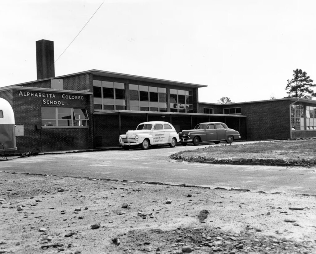
Education followed a similar trajectory. When desegregation began in the 1960s, the process was uneven and often resisted. In North Fulton, Black students had long attended separate schools, including the Bailey-Johnson School, which served as a central institution for decades before closing in 1967.
As integration slowly moved forward, many families turned to private schools or relocated, contributing to a pattern where school systems—and the neighborhoods around them—continued to reflect longstanding divisions.
Today’s school reputations, often cited as a reason families move to North Atlanta, are part of that longer story.
The New Boundaries of the 21st Century
In more recent years, separation has taken on different forms. The incorporation of cities like Johns Creek and Milton brought local control over zoning, services, and tax revenue. While often framed in terms of efficiency and governance, these changes also allowed communities to shape their own development patterns more tightly.
That control can influence everything from housing types to density, reinforcing differences between neighboring areas.
At the same time, home prices across North Fulton and South Forsyth have climbed sharply, creating another layer of separation—one based on affordability.
Patterns of housing, school zoning, and development continue to guide where people live and how communities form. In many cases, those patterns still echo decisions made decades earlier.
What This Means Today
Understanding this history doesn’t change the present overnight. But it does clarify something important: the region’s growth was not just a matter of timing or market demand. It was shaped—intentionally—by policy, infrastructure, and choices about who belonged where. And those choices, even when no longer visible, continue to influence daily life.
North Atlanta is often described as one of the most desirable places to live in Georgia. That remains true. But like many successful regions, its story is layered. The neighborhoods, roads, and city lines that define it today are part of a much longer map—one that is still, in many ways, being drawn.
Read Also:
About the Author


In North Atlanta

Dervish Plans 200-Seat Turkish Restaurant in Johns Creek

Dumpling Master Opens at Peachtree Corners Town Center
5 Coffee Trucks and Mobile Cafés Worth Finding Around North Atlanta
Simple Man Distillery Hiring Ahead of Cumming City Center Opening

Pumpkin Season Arrives in North Atlanta, With $7.99 Grocery-Store Carvers and Farm Weekends Ahead

Roswell Approves Champions Place Expansion for Adults With Physical Disabilities
IN NORTH ATLANTA