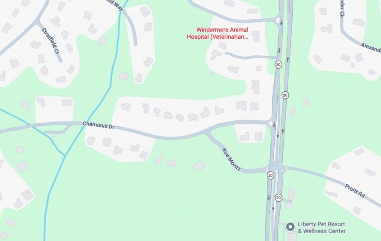
Before Johns Creek and Alpharetta: The Cherokee and Creek Lands of North Atlanta
Get major local stories and development updates.
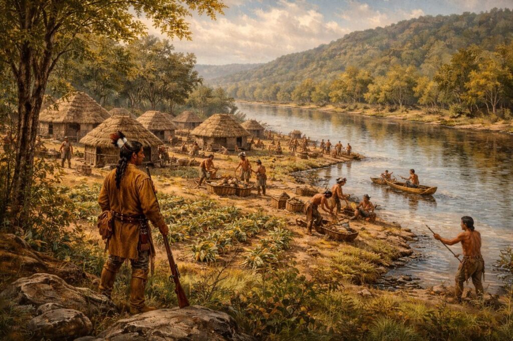
Long before subdivisions, tech offices, and suburban town centers reshaped North Atlanta, the land that now includes Johns Creek, Alpharetta, Milton, Duluth, and Suwanee was part of a much older landscape. Rivers, forests, and rolling hills defined the region, and the people who lived here organized their communities around waterways, trading paths, and seasonal agriculture.
For centuries, the northern arc of metro Atlanta was home to Native American nations, most prominently the Cherokee and the Creek. Their presence shaped the geography, place names, and early transportation routes that still influence the region today.
Modern residents driving along the Chattahoochee River or through northern Gwinnett County are moving through land that once supported villages, trading routes, and agricultural settlements long before Georgia became part of the United States.
The Chattahoochee River as a Lifeline
The most important geographic feature in this region has always been the Chattahoochee River. Long before it became a recreational corridor or a scenic boundary between counties, the river functioned as a lifeline for Native American communities.
The word “Chattahoochee” itself comes from a Creek language phrase often translated as “painted rocks.” The river served as a natural transportation route and a gathering place for communities living along its banks. Streams that feed into it, including Suwanee Creek and Big Creek, created fertile areas where villages could develop.
Communities used these waterways for fishing, travel, and trade. The forests surrounding them provided game and materials for shelter and tools. Trails connecting river crossings gradually formed an early network of paths across the region.
Many of those routes would eventually influence the placement of later wagon roads and highways.
Cherokee Territory in North Georgia
By the eighteenth and early nineteenth centuries, much of North Georgia—including the land that is now North Fulton and Forsyth counties—was part of Cherokee territory.
The Cherokee Nation had established towns and agricultural settlements across the region. Families cultivated crops such as corn, beans, and squash, while hunting and fishing remained important parts of daily life.
Villages were typically located near rivers or creeks, where fertile soil and water access made farming easier. Trails connected these settlements to each other and to trading routes extending across the southeastern United States.
The Cherokee also developed sophisticated political and social systems. By the early 1800s they had adopted a written language, established schools, and created a constitutional government modeled in part after the United States.
Despite these efforts to coexist with expanding American settlements, pressure for land grew rapidly as white settlers moved into northern Georgia.
Creek Influence Along the River Corridor
Before the Cherokee consolidated control over large portions of North Georgia, Creek communities also occupied significant parts of the region, particularly along major rivers.
The Creek Confederacy consisted of numerous towns spread across present-day Georgia and Alabama. These towns often sat along waterways that allowed trade with neighboring communities.
Even after Cherokee influence expanded northward, Creek cultural influence remained embedded in place names and geographic references. The Chattahoochee River itself reflects this heritage, as do several other regional names.
For Native communities, rivers served as both boundaries and connections. The same waterway that separated territories could also link villages through trade and travel.
The Native American Place Names of North Georgia and What They Mean
Many of North Georgia’s best-known place names come from Native American languages, especially those connected to Creek and Cherokee history. Even in today’s suburban landscape, those older names remain part of the map, quietly preserving traces of the region’s deeper past.
Chattahoochee is generally understood to come from a Creek phrase often translated as “painted rocks,” a reference to the river’s distinctive stone formations.
Suwanee is widely linked to Native American origins as well, though historians differ on the exact meaning. Some connect it to the Shawnee people, while other accounts suggest related meanings such as “echo.”
Etowah is believed to come from a Muscogee-language term often interpreted as “town” or “settlement,” while Oconee and Coosa also reflect Native linguistic originis tied to older communities and river systems across Georgia.
Suwanee Old Town and Early Settlements
One of the best documented Native American sites in the northern Gwinnett area was known as Suwanee Old Town. Located near where Suwanee Creek meets the Chattahoochee River, this settlement flourished long before the modern city of Suwanee emerged.
Historical accounts describe the site as a large village that existed for generations. Early records connect it with Shawnee inhabitants, while later government documents indicate Cherokee and Creek communities also occupied the area.
The village appears on maps associated with land cessions made to the United States in the early nineteenth century. The Cherokee ceded portions of land in 1817, followed by Creek cessions in 1818.
Although the modern city of Suwanee developed several miles away from the original village location, the town’s name appears to have remained tied to this earlier Native settlement.
Today, the surrounding region has transformed into suburban neighborhoods and commercial corridors, but the historical record still points to a much older story beneath the modern landscape.
The Trails Beneath Today’s Roads
Long before paved highways connected Atlanta’s suburbs, Native American trails crisscrossed the region.
These paths followed natural contours of the land, linking rivers, villages, and trading areas. Some were used for centuries as communities moved goods and information across the southeastern woodlands.
When European settlers arrived, they often adopted these same routes because they were already well established and navigable. Over time the trails widened into wagon roads, then later into modern transportation corridors.
While the exact alignment of many early trails has been lost, historians widely recognize that Native American routes shaped the development of Georgia’s early road network.
In many cases, today’s roads follow paths first walked hundreds of years ago.
Historic Trading Routes That Later Became North Georgia’s Roads
Several major transportation routes in North Georgia follow corridors that were first used by Native American traders and travelers. These paths connected river crossings, villages, and hunting grounds long before modern towns developed in the region.
Peachtree Road and Peachtree Street in the Atlanta area are believed to follow portions of an older Native American trail that ran along the Chattahoochee River toward a Creek settlement known as Standing Peachtree.
Buford Highway developed along an early travel corridor connecting settlements north of the Chattahoochee River. Over time the route became an important wagon road linking Atlanta with communities such as Duluth and Buford.
Lawrenceville Highway and other early Gwinnett routes followed paths used by traders traveling between Cherokee settlements in North Georgia and Creek communities to the south.
These roads evolved over generations—from footpaths to wagon routes, and eventually to modern highways—but many still reflect the geographic logic of the original Native American trails that crossed North Georgia centuries ago.
The Forced Removal of the Cherokee
The presence of the Cherokee Nation in North Georgia came to a devastating end in the 1830s.
As white settlement increased and gold was discovered in northern Georgia, pressure grew for the removal of Native American communities from their ancestral lands. The federal government eventually enforced a policy that forced the Cherokee to leave.
In 1838 thousands of Cherokee people were removed from Georgia and surrounding states and marched westward to what is now Oklahoma. This journey became known as the Trail of Tears.
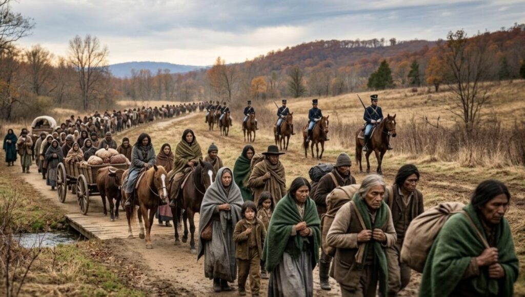
The removal opened large areas of North Georgia to new settlement by American farmers and land speculators. Land that had belonged to Cherokee families for generations was redistributed through lotteries and private sales.
Communities such as Alpharetta, Roswell, and Cumming would eventually emerge within these newly opened territories.
The Landscape Transformed
In the decades that followed the Cherokee removal, the region slowly shifted from Native lands to agricultural communities.
Farmers cleared forests to plant cotton and other crops. Small railroad towns developed during the late nineteenth century as rail lines extended across northern Georgia.
Communities like Duluth and Suwanee grew around depots, while farming dominated the surrounding countryside for generations.
The transformation accelerated in the late twentieth century. The expansion of Atlanta’s suburbs, the construction of highways, and the growth of technology and corporate jobs brought rapid development to North Fulton and northern Gwinnett.
Cities such as Johns Creek and Milton, which did not even exist as incorporated municipalities until the twenty-first century, became major suburban centers.
Remembering the Earlier Story
Today North Atlanta is often associated with highly ranked schools, expanding business districts, and new mixed-use developments. Yet the land beneath these communities carries a much longer history.
The rivers, creeks, and ridgelines that shaped Native American life continue to define the geography of the region. Many local place names still reflect Native languages and cultural influence.
Understanding this earlier chapter helps place the modern suburbs in a broader context. The story of North Atlanta did not begin with highways or subdivisions.
It began centuries earlier along the banks of rivers where Native American communities built villages, followed forest trails, and created the earliest human landscape of the region.
Are There Remnants of the Cherokee and Creek in North Georgia Today?
In the years following the Trail of Tears, most Cherokee people were relocated to what is now Oklahoma. Today the Cherokee Nation and the United Keetoowah Band of Cherokee Indians are federally recognized tribes headquartered there. However, another federally recognized tribe—the Eastern Band of Cherokee Indians—remained in the southern Appalachian region and now lives primarily in western North Carolina.
Some Cherokee families also avoided removal by hiding in remote mountain areas or by integrating into surrounding communities. As a result, descendants of Cherokee and Creek peoples still live across the Southeast, including in parts of Georgia.
Genetic studies suggest the share of people with measurable Native American ancestry in the South is generally only a few percent or less.
Why So Many Southerners Believe They Have Cherokee Ancestry
Across the American South it is common to hear family stories about having a Cherokee ancestor. Historians say these traditions became widespread for several reasons. In the 1800s some families with Native ancestry blended into surrounding communities after the Cherokee removal, passing down fragments of their heritage through oral history. In other cases, family legends emerged generations later as people tried to explain unusual surnames, darker features, or old regional stories. Genealogists also note that claiming Cherokee ancestry sometimes became socially easier than acknowledging other complex family histories in the South. While some families do have documented Cherokee lineage, many stories remain unverified. Today, confirmed tribal ancestry usually requires historical records and enrollment through one of the federally recognized Cherokee tribes.
Archaeological Sites and Historic Areas
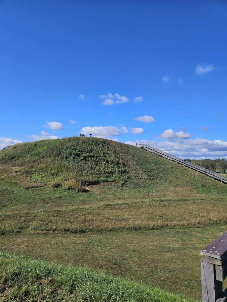
North Georgia also contains numerous archaeological sites connected to Native American history. Some of the most significant are ancient mound complexes built by earlier Mississippian cultures.
The best-known example is the Etowah Indian Mounds near Cartersville, one of the most important Native American archaeological sites in the southeastern United States. The complex includes large ceremonial mounds and artifacts dating back nearly a thousand years.
The Etowah settlement flourished roughly AD 1000–1550, hundreds of years before the Cherokee controlled North Georgia. Archaeologists consider Etowah one of the most important Mississippian sites in the United States.
What happened to them?
By the 1500s, the Mississippian system began to decline, likely due to disease, warfare, and social changes that followed early European contact in the Southeast.
After these earlier societies declined, new tribal groups—including the Cherokee—expanded into North Georgia.
So the timeline looks like this
- Mississippian culture (Etowah) — AD 1000–1500
- Cherokee and Creek peoples — 1600s–1830s
- U.S. settlement after the Cherokee removal — 1830s onward
Many people assume the Cherokee built the Etowah mounds because the Cherokee were the Native nation living in North Georgia when Europeans arrived. But the mound builders were part of an earlier civilization that existed centuries before.
Closer to North Fulton and Gwinnett, sites like Suwanee Old Town, located near the confluence of Suwanee Creek and the Chattahoochee River, are believed to have been major Native settlements before the nineteenth century.
Although many historic village locations have been lost to later development, archaeological research continues to reveal evidence of long-standing Native communities across the region.
Crops and Agricultural Traditions
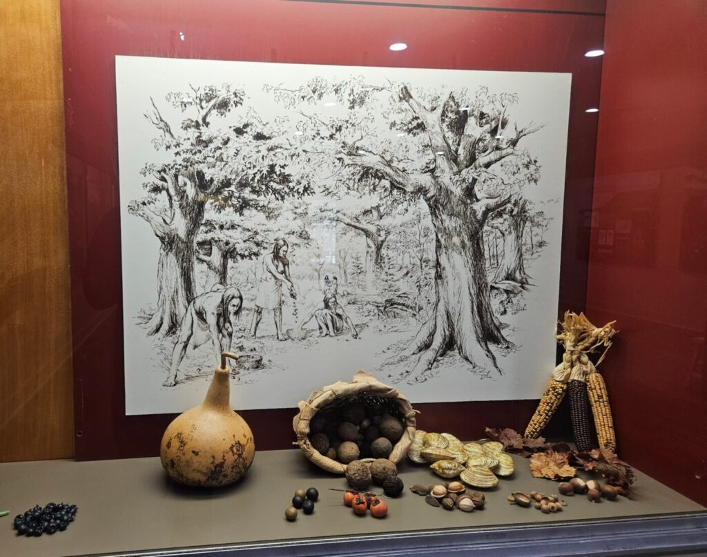
Native agricultural practices also shaped the early landscape of the Southeast. Crops such as corn, beans, and squash—often referred to as the “Three Sisters”—were widely cultivated by Native communities long before European settlement.
These crops became central to Southern agriculture after settlers adopted them. Corn in particular remained one of the most important crops across Georgia well into the twentieth century.
While modern agriculture has changed dramatically, the agricultural knowledge first developed by Native peoples helped shape early farming practices throughout the region.
Cultural Memory and Modern Recognition
Today, public awareness of Native history in North Georgia continues to grow. Historical markers, museums, and educational programs increasingly highlight the role Cherokee and Creek communities played in shaping the region before modern cities emerged.
Local schools, parks, and historical organizations often incorporate Native history into educational programs about the area’s past. The Chattahoochee River corridor itself—once a vital travel and trading route for Native peoples—remains one of the most important natural landmarks in North Atlanta.
Although the Cherokee and Creek were forcibly removed from their ancestral lands nearly two centuries ago, their influence remains embedded in the geography, language, and historical memory of North Georgia.
About the Author


In North Atlanta

Fall Is the Right Time to Repair Many North Atlanta Lawns

Dervish Plans 200-Seat Turkish Restaurant in Johns Creek

ANDRITZ Is Hiring Engineers and Project Leaders in Alpharetta
Old Milton Parkway Widening Will Reshape Avalon Corridor Through 2029

Suwanee’s Winton Machine Heads to Washington With $400,000 on the Line

Medley Opens First Access to 133 Townhomes in Johns Creek
IN NORTH ATLANTA